Typical applications:
- Monitoring rivers & streams,
- Flood monitoring,
- River basin simulation
- Roadway monitoring for flood conditions
- wells, snow, dams, water tanks, irrigation flumes and weirs, soil moisture, and many others.
What Can ToltHawk Do?
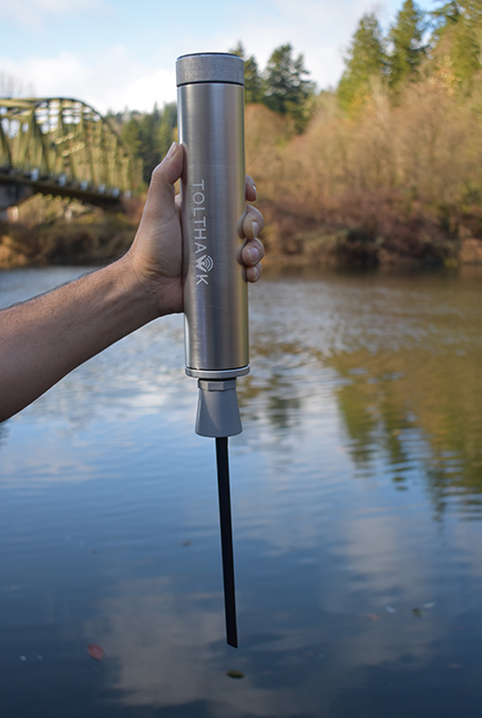
- Sensors: water level, depth, temperature, traffic vibration, and tilt alarm. Additional add-on sensors include: rain bucket, external temperature and humidity, wind anemometer, soil moisture, LiDar depth sensor, pressure transducer, and many more.
- Web: Easy to understand web/phone application gives you a geographic dashboard view of all locations statuses in one place. You can also further drill down for detailed information for each location.
- Text and Email Notifications: You can get notifications via text or email when certain thresholds are reached. For example you can set notifications for different levels of water under a bridge or a road.
Why ToltHawk?
The unique design of our device makes it easy to install for use, yet powerful, rugged, and low cost. No wires to pull, nor any calibration required. All configuration is online and can be done after installation, from the convenience of your desk.
What’s New in Version 3.0?
The third generation of ToltHawk Level Sensors works maintenance-free for 5 to 10 years. Other new features include:
- Richer web and phone interface
- Rugged and watertight design
- Ability to integrate with sites like ESRI and Amazon Alexa
- New API allows easy 3rd party integration
- Automatically bring in relevant data from other external sources (NOAA weather, precipitation, in basin USGS gauges, lidar contour )
- For locations with no cellular coverage, you can now use LoRaWAN to transmit data to the cloud
- and many more…
How Is Data Sent?
- Wireless:
- Cellular: LTE, CAT M1, NB-IoT, 2G (auto switchable)
- Auto switched for the best network. In US AT&T, Verizon, T-Mobile are supported
- LoRa see LoRa vs Cellular
- Cellular: LTE, CAT M1, NB-IoT, 2G (auto switchable)